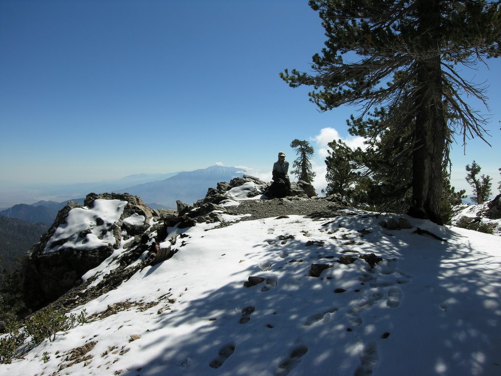
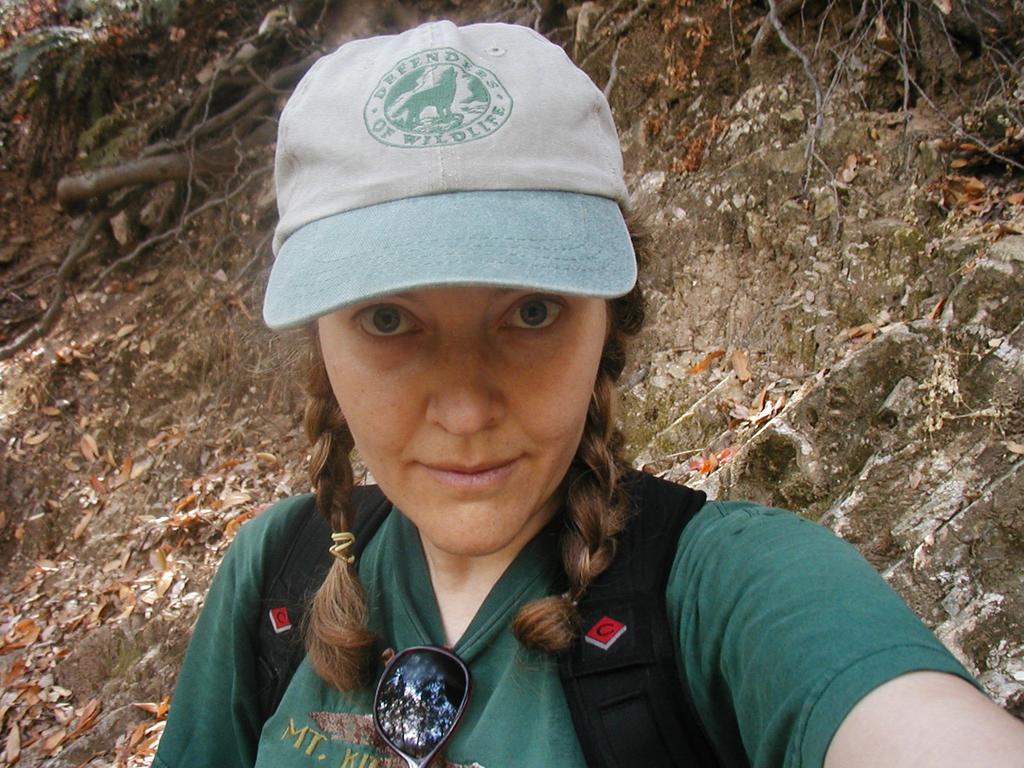
Sharon: Whaddya say we do the loop at Chantry Flat and we can stop by to wish Chris and Joan a Merry Christmas?
Carolyn: Groovy
So they set the alarm for just before dawn,
Coffee to go they stumbled along;
A sultry pine watched them with conical eyes,
The sky frozen blue with marshmallow pies;
This morning is brilliant they both would agree,
And they smiled as they listened to the voice of the stream.
The waterfall kept them as if an old friend,
The boulders allowed them to pass once again;
An old fallen tree took them gently across,
A spider's web whispered the simplest thought;
The pack can be heavy but open your mind,
If you stay long enough you can leave it behind.
They confer on this thing for a minute or two,
And conclude for today eleven will do;
A new point of view is often the key,
Each obstacle just a new chance to succeed;
Peace to each one they may pass on the way,
Best wishes and hope for the Christmas Holiday!
Tuesday, December 13, 2005
Monday, December 05, 2005
Mt. Wilson via the Kenyon-Devore Trail
The last time we attempted this trail we ran into hunters at the junction and promptly turned around having only made it 3+ miles in. Seeking closure (hunting season having passed) we found ourselves back at the stream crossing, discussing the beautiful day and the cold weather while having a small snack before heading up. We did a twelve mile loop and saw not one other person on the trail. Ice spots on the road atop Wilson didn't slow us. We arrived at Red Box at 7:30am and finished the loop at 12:00 sharp. Elevation gain remains a mystery but I think the portion of the hike on the kenyon devore trail is about 2500 in gain. The last five miles is, of course, all downhill.
Wednesday, November 16, 2005
The Stove...
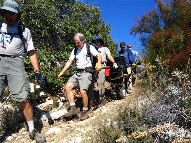

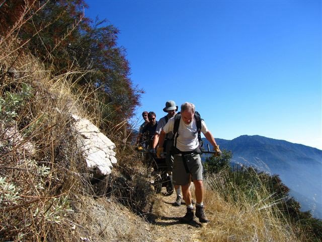
How many men does it take to move a 400+lb stove 3 greuling miles on a steep and narrow trail?
Let's take a look at the men who did it.
Chris Kasten, Canyon Dave, Gary Keene, Rich Cageao & John Peel
**All photos courtesy of Steve Burns.**
On The Trail With Ted
This week we had the good fortune of hiking with our friend Ted. We haven't seen Ted for several months and we were beginning to wonder if he'd run away to join the circus or what. We gave him a ring to remind him how much fun we are and he agreed to meet us at the trailhead at 7:30am. Tweenie was not as easily coerced and opted to stay in LaCrescenta.
Ever alive with useful bits of knowledge, Ted gave us his recepie for the preparation of Acorns in return for our help in gathering four pounds of the nut being careful to choose only the ones without the little holes. While kneeling on Zion surrounded by a plethora of the largest acorns we had ever seen and carefully inspecting each one for tenents, Ted indulged the following:
Remove the shells and soak the nuts for five days in fresh water, changing the water each day to remove the tanins. After five days remove the nuts and dry them. You can put them in an oven for about 30 mins at 250^ or just let them sit in a dry place. Ted includes Liquid Smoke in the soaking process but says you can also add that at the point of baking. Be certain to check the nuts for mold which can occur within one day if a person is not careful, nut mold being a serious condition which renders the nut inedible and, in fact, has been linked to some kinds of cancer.
We hope Ted can join us again soon and perhaps instruct us further in the edible forest.
Cheers!
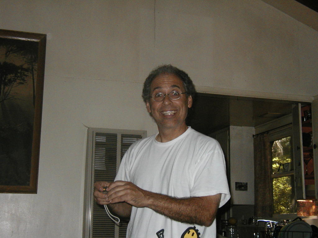
Meet Steve Burns!
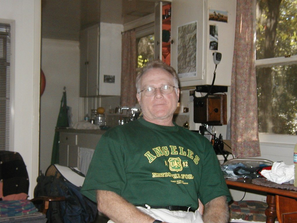
On the latter portion of our 10 mile loop, we ran into Steve Burns. Steve has been a cabin owner in the lower Winter Creek since 1975 and can often be found out this way on the weekends enjoying the solitude. Steve took the trail back with us making us a group of four for the final three miles. It was a pleasure to hike with Steve as he is a source of seemingly limitless information on the history of the Canyon, as well as what its like to be a cabin owner, which involves far too much brush clearance for us. Steve is also currently the president of the Cabin Owner's Association and oversees matters involving the cabin owner community. We also learned that Steve is an avid knife and sword collector specializing in modern styles which incorporate oriental styling and we are anxious to someday view his display of swordery.
Maybe the best way to get to know Steve, however, is through his photography. An accomplshed photographer, Steve has been photo-recording moments in the canyon for many years and, in fact, we knew of him through his photos long before we ever had the pleasure of actually meeting him. Uninhibited even by the severe flooding of this past winter, Steve was able to bring us some amazing shots exhibiting various stages as the road collaped and the the canyon reclaimed itself leaving all but the most determined locked out. In contrast, some of his other work captures the beauty and serenity of the canyon when nature is at its most assuring. Steve's talent and fierce determination in documenting the complicated layers of nature's expressions prove Steve's heart is firmly rooted in the Santa Anita Canyon.
Monday, November 07, 2005
The Mt. Zion Trail
Mt. Zion Loop Trail
eleven miles
welcome overcast
lots of bugs
four hours
not another soul on the trail
Beware:
ticks embedded in the flesh
cause a nasty sting
Monday, October 31, 2005
Sunday October 30, 2005
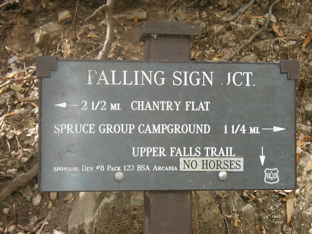
Where: First Water Trail to Falling Sign Junction
What: 11 miles
Sharon says: little shoots of grass make it seem like spring but where are all the bats?
What: 11 miles
Sharon says: little shoots of grass make it seem like spring but where are all the bats?
Friday, October 21, 2005
San Gorgonio
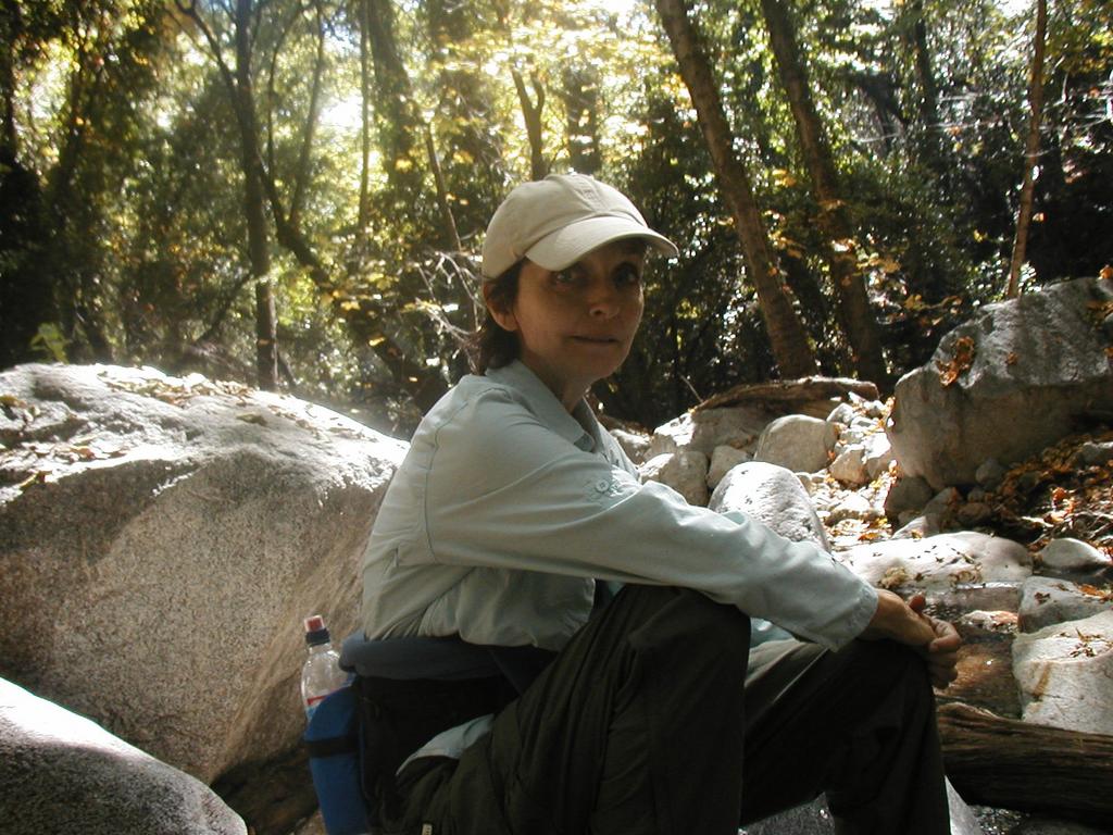
Last week Sharon and I were turned back from the lovely Kenyon-Devore Trail because of hunters. Sharon immediately reversed the negative energy by taking on San Gorgonio. This mountain stands 11,500 ft in the San Bernardino mountain range and in my humble opinion, is one of our most beautiful trails. It's about 2+ hours from Los Angeles but I think Sharon would agree that it's well worth the trip and she sends the following report of her trek.
"Well San Gorgonio was the best of both worlds. It made me laugh, it made me cry. There was anywhere from four to six inches of snow which slowed me down quite a bit. I made it to the ridge, a little over ten thousand feet in elevation and had the good sense to stay there, eat my lunch and enjoy the view. It was, as you know, spectacular. On the way down I was comming to a blind curve in the trail and as I got close to it who should be ambling towards me but a big , brown bear. We both froze when we saw each other. We were very close and it was very exciting and a little unnerving at the same time. The bear was beautiful. I turned around slowly and started walking back toward Richard who was not far behind me. The bear started down the mountain. I kept motioning for Richard to be quiet and look down because I didn't want to scare it away. Richard said it was the bigest bear he had ever seen. It was great. We started up at 7am and were back down at 7pm. It was a long day. I left my house at 4:30am and got home at 8:30pm. Then my sister and I went biking on the beach yesterday. It was like some triathelon. I refused to swim to Catalina this morning and slept in. I needed the sleep. It was great fun but somewhat difficult. Two people went to the summit but didn't make it because of the snow. I can see why you love the place."
"Well San Gorgonio was the best of both worlds. It made me laugh, it made me cry. There was anywhere from four to six inches of snow which slowed me down quite a bit. I made it to the ridge, a little over ten thousand feet in elevation and had the good sense to stay there, eat my lunch and enjoy the view. It was, as you know, spectacular. On the way down I was comming to a blind curve in the trail and as I got close to it who should be ambling towards me but a big , brown bear. We both froze when we saw each other. We were very close and it was very exciting and a little unnerving at the same time. The bear was beautiful. I turned around slowly and started walking back toward Richard who was not far behind me. The bear started down the mountain. I kept motioning for Richard to be quiet and look down because I didn't want to scare it away. Richard said it was the bigest bear he had ever seen. It was great. We started up at 7am and were back down at 7pm. It was a long day. I left my house at 4:30am and got home at 8:30pm. Then my sister and I went biking on the beach yesterday. It was like some triathelon. I refused to swim to Catalina this morning and slept in. I needed the sleep. It was great fun but somewhat difficult. Two people went to the summit but didn't make it because of the snow. I can see why you love the place."
Tuesday, October 04, 2005
Joe, Chris and the Megatransect!
For four days in September, explorers Joe Tortomasi and Chris Kasten toured a remote, wild and forested part of rugged ridge and canyon country called Devil's Canyon. Their cross-country journey followed an uninhabited swath of territory that runs for miles through the San Gabriel Wilderness – an area that contains thick forests, swamps, rivers, lowlands, an incredible array of wildlife, and few, if any, permanent human settlements. The land is too foreboding for most. It's hot, infested with insects and snakes, and home to large animals that can be dangerous. For Joe and Chris, its paradise.
We had the opportunity to talk with Joe and Chris as they remembered a frightening moment on the trip when they encountered a ferocious black bear!
"We approach within a hundred feet of an oblivious female as she works her way through a wild berry bush, nipping off the tender red fruits, tossing the rest aside. Her face is tranquil, with dark eyes shaded beneath the protrusive brow. The long nose sniffing out the sweetest bulbs. Her paws are huge but she tread carefully in this ritual. When she suddenly raises her head to look straight in our direction, the intensity of her stare seems to bring the whole forest to silence. For a minute or two she looks puzzled, wary, menacingly stern. Then she resumes eating. Every muscle in our bodies froze during those seconds she glowered at us. We couldn't lift the camera, not daring to move, while mosquitos were dining on our arms and legs."
So, unfortunately there is no photo of this particular moment but we are assured that treacherous river rafting as well as an exhausting battle with a black rattler have been well documented.
Well, someone's got to do it.
Until next time.
Monday, October 03, 2005
The Rim Trail
Mt. Wilson: 5715 ft. (1742 meters)
Sturtevant Camp: 3200 ft. (975 meters)
Five hours (including a short visit with Chris)
Magnificent.
Sharon winces when she hears me mention the Rim Trail loop. I've been slipping it into our conversations of late trying to get her used to the idea of it so when the weather finally cooled I could suggest it without her being too surprised. Still, she gasps. It's not the winding six miles, gently dropping 2500ft into Sturtevant Camp that makes her uneasy but the climb out, being less than three miles straight back up to the top, which causes her resistance. I know we can do it, even if we suffer just a little, and I convince Sharon that thinking too much of it is the real enemy here anyway. So, we set forth to conquer with all we've got and hopefully have a few laughs along the way, if only at ourselves.
This is one of my favorites and the best part comes as we approach about 4,500 ft. We no longer have to think about poison-oak or rattlesnakes. The trees up here are more considerate and allow each other a little more space leaving us with the chance that we might see a deer or even a fox. I could lie down and smother myself in the scent of pine, the screech of the mountain blue jays and the gurgle of the ravens. In fact, I almost do so unwillingly, as the trail is covered with acorns like marbles beneath our boots. We climb higher and stop on a ridge with a view of Mt. Baldy just as I remember the tangerines in the bottom of my bag and dig for them. The trail becomes sandy and hot but the views become more spectacular and we remember the time, almost one year ago, when we surprised a big white owl.
Up on top, we conclude that it's all in the pacing and Sharon agrees to let me put it in writing that it wasn't that bad after all and she would definitely do it again. So, there.
High-fives and gingerbread men all around.
Wednesday, September 28, 2005
Meet Chris, Joan & Natalie!
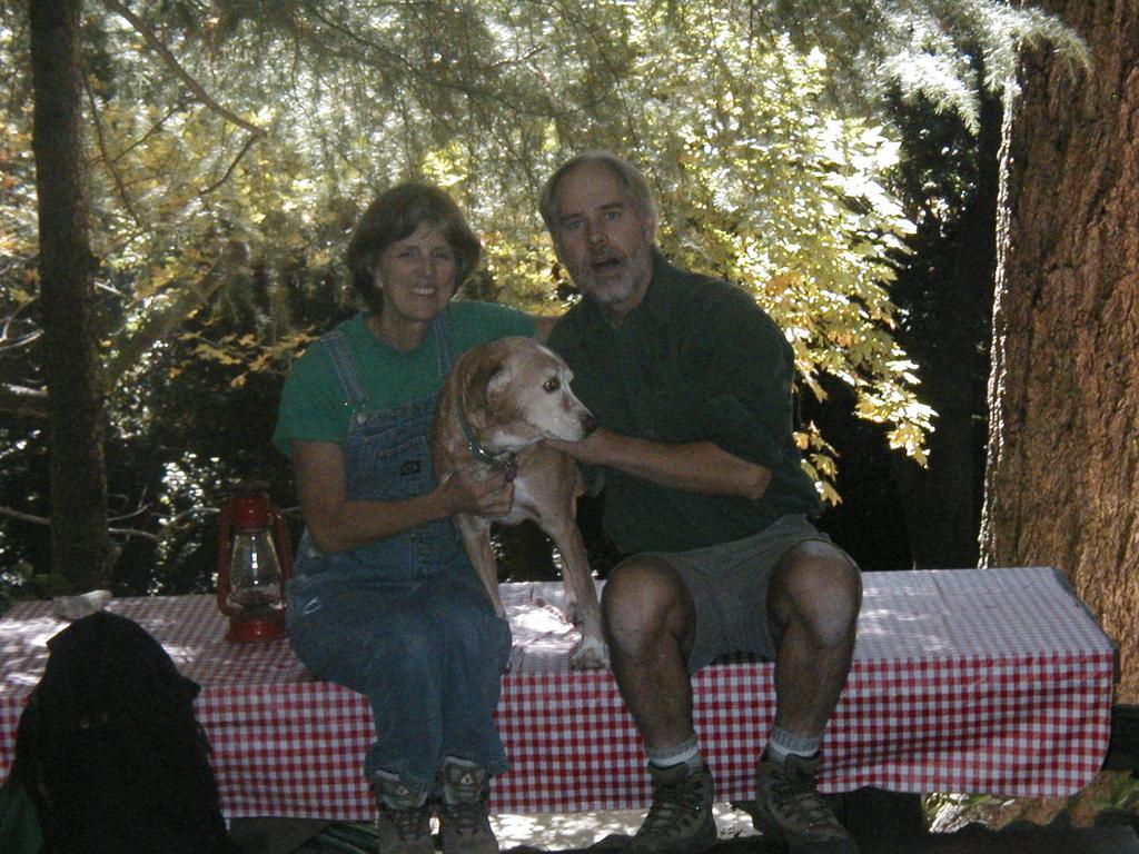
This weekend we headed out to the Mt. Zion loop trail and I am pleased to say that while on the trail we had it all to ourselves. Living in the center of Los Angeles I'm always amazed that this kind of solitude is no more than a short drive away. I am further pleased to report this may be the first weekend in several months we did not need to negotiate our way around a rattlesnake or otherwise remove one from the trail, the latter being an unfortunate rite of passage which Sharon expertly supervises from six feet behind me.
The Mt. Zion loop trail crosses directly through Sturtevant Camp and we had the pleasure of stopping in to visit with our friends Chris, Joan and their dog Natalie. Chris and Joan have been the Camp managers for fifteen years now and are always available with a cheery hello! Once we were caught up on the progress of the micro-hydro-electric project and any canyon gossip, we questioned Chris about rattlesnake strategy. Chris confidently assured us that most bites to humans are in-fact dry and that a rattlesnake can only strike accurately a distance equal to one-third the length of its body. How we might judge this distance with a hissing reptile at our feet we considered only momentarily. Chris and I go way back and I consider him to be a reputable source of information with respect to these sorts of things. This being the case, we set off with a new sense of security.
Cheers!
** Chris if you're checking in – since you asked, the trail from camp over Zion is so overgrown it seems more like a deer trail now in some places. There is some ducking, as you mentioned, and the path is washed out in a few places. None of this bothers us 'cause… you know… we can take it.
We may head over the Rim Trail next week and if we do we'll see you then!
Monday, September 19, 2005
Meet Allen Wolff!
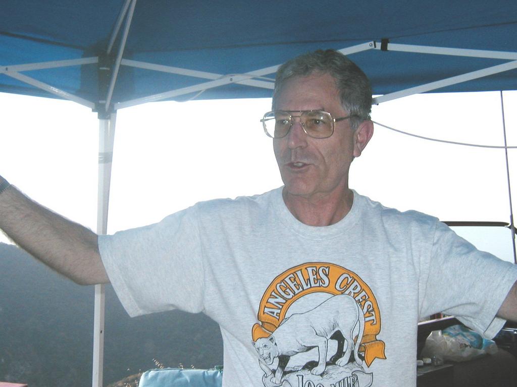
Ever have the desire to run 100 miles through the forest? 83 people had just that desire this past weekend and so participated in The Angeles Crest 100 mile endurance run. The course, beginning in Wrightwood and ending at the Rose Bowl, traverses some of the most beautiful trails in the San Gabriel mountain backcountry.
While on one of our favorite 11 mile treks, Sharon and I had the pleasure of meeting a few of the volunteers who make the race possible. These extraordinary people were still supporting several of the final runners at the 75 mile mark of Chantry Flat, the race having been underway now for approximately 28 hours! We stopped for a few moments to talk with Allen Wolff, communications specialist. Allen brings his HAM radio expertise to the race as part of a coordinated safety measure.
Q: Hi Allen, it's nice to meet you and thank you for talking with us today! Can you tell us a little bit about what you do here and what part you play in making the race a success?
A: Sure and It's great to meet you too! We are happy to be able to provide safety communications for the runners in the race. The stations are located at 19 checkpoints for the 100 miles. People run through the woods for 100 miles. And there is a vertical gain and vertical loss of about 46,000 ft. They run up and down hills through the woods! They start in Wrightwood at 5:00 am on Saturday and they finish by 3:00 pm Sunday afternoon at the Rose Bowl. We work with the race people in an organizational structure. We support them by providing communications. You can't use celphones for the most part when you're deep in the woods so our database tracks the runners when they leave one checkpoint and come through our checkpoint and proceed to the next checkpoint. My world is these three checkpoints. From here I don't get the opportunity to see any of the runners but I know all the names and numbers because my database tracks them. The man who developed the database is very, very clever and the numbers change color on my screen if the person is on the trail to long. You see, they know the average time it takes to get to Newcomb from Chantry Flats, for example, and if the runner goes over that average time it goes yellow and if he goes way over it goes red and then we get concerned and then they can send some race people down the trail to look for the runner or if there is a report of a runner being injured we can get search and rescue out there. Two years ago, we had a woman who got dehydrated on the trail between us and Newcomb and needed support. Some runners had gone down to help her out and by the time she got out we had Sierra Madre Fire up here with a fire truck and ambulance to take her to the hospital. So we have Sierra Madre Search and Rescue available to us. We can get a helicopter here if necessary; it depends on what the situation is.
For lots more information on the race, log on to www.ac100.com.
Monday, September 12, 2005
Going Solo

I haven't been hiking on my own for some time and it can be difficult to self-motivate on a cozy Sunday morning. I dug deep and somehow got myself to the trailhead by 8:00am. The road to our favorite trail has been closed for so long I can't remember the last time it was open. The rains last year resulted in the road collapsing in several places and it is just now being propped back into place. Usually, we walk up the three mile road but on this day I brought my bike. I'm always telling Sharon that the bike up would be easy and I must remember to mention to her that it is more tiring than I thought it would be. Nevertheless, I locked it at the pack station and set off to re-discover some peace of mind and re-acquaint myself with me.
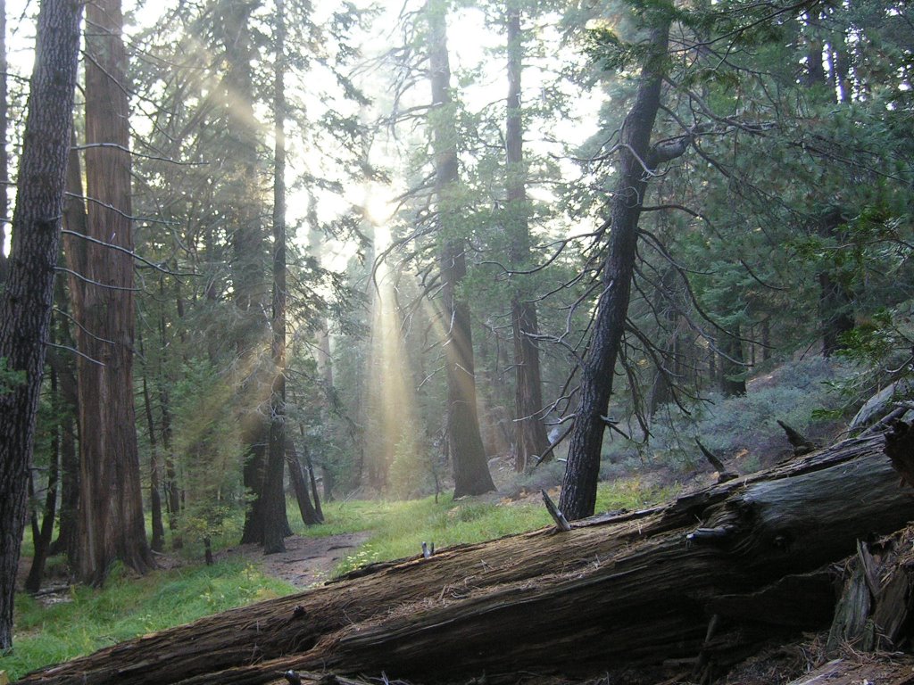
Today I was lucky. The morning in Santa Anita Canyon welcomed me with just enough cloud cover to keep me cool and a slight breeze to discourage the blackflies. The golden leaves covering the trail suggest autumn but the air is absent a morning chill and I reached the shade of the tall pines just as the sun began to explode through the tiny cracks in the grey sky.
Sharon and I know many of the cabin owners and our hikes in this canyon often include visiting friends. This morning I saw someone I didn't recognize emerging from his cabin and he greeted me with a raised cup of coffee. Sharon, however, is the friendly one of us and all I could muster was a lifted palm with a wilting 'hello' as I whisked by. Had Sharon been with me, that guy would be featured here. Insecurity - 1.
Few others ventured out this day and I intruded on none but the quick squirrels with their mellifluous squealing to break the sweet silence.
Until next time.
Monday, August 29, 2005
Temescal Canyon
The heat and the swarming black flies encouraged us to take a small break from the Angeles. We chose Temescal Canyon for a short get-together. We took the trail to Will Rogers and sat for a moment at the Inspiration Point overlook with view of the ocean before heading back the way we came.
The Santa Monica mountains are often over-crowded especially on the weekends. Those who rise early, however, will be rewarded with a few moments of solitude, a view to the ocean and the sweet smell of eucalyptus and fennel. Our rewards on this day also included one crouching bobcat, one rattlesnake retreating into the brush and the biggest spider I have ever seen (well maybe not the biggest).
The Facts are:
We went about 5 miles.
It must have been 100 deg (at least!).
The bathrooms at temescal don't open until 7:02, there's no paper in there and they were last cleaned in 1998.
Tuesday, August 23, 2005
August 21, 2005
The Facts are: We hiked 13.5 miles total; our route on this day was Red Box to the Kenyon Devore Trail up to the top of Wilson and down the Wilson Road.
We were on the trail at 7:45am. The bugs were swarming us and headnets were definately in order. Actually the bugs are even annoying with the headnets because they cover the outside of the net which makes me feel creepy. We weren't sure how long the Kenyon Devore trail was and it turns out it was 3.5 miles. About two miles in there was a old beach chair (note: this was not a lightweight camp chair) discarded along the side of the trail. It was Sharon's idea to carry it out. I must admit that, although it was heavy, I was glad we did. I left it at the top in hopes a ranger would dispose of it. I fully expect to see it there the next time we visit.
We didn't see any wildlife today but the trail was peaceful. We saw few people most of the day and no one at all on Kenyon Devore. It was one of the most beautiful days and may well have been perfect if not for the bugs.
Monday, August 22, 2005
August 7 & 14, 2005
August 14, 2005
The Facts:
On the road at 7:00;
Our route was up the Chantry road and around the small loop via the first water trail 11+ miles;
Lots of water out there still.
We drove out to Chantry Flat and parked in the shady spot under the tree. We had a great walk up the road as it was cloud covered and so not too hot. Canyon Dave passed us on the way up and suggested we meet him at the top. We joined Dave for part of his Patrol which was fun. We got to see half-dozen or so cabins, learned some history of the canyon and had a nice chat. Dave informed us of emergencies which could occur and instructed us on various escape routes. I trust that Sharon remembers the details.
Along the way we saw two rattlesnakes and one deer.
August 7, 2005
The Facts:
We were on the road from Sharon's house at 7:00am;
We hiked 12 miles;
The water is still running;
The bugs are swarming and if you don't have a headnet they will drive you completely insane.
It was a beautiful day to hike out to West Fork Campground and back the same way. We hauled two salt bricks for our "salt the deer mission."
When we got there, we saw two people sitting in camp chairs outside of the red cabin where the deer stall is. We chatted for a moment with them and learned they own the cabin which I had thought until now was a forest service/ranger cabin.
The peeps had brought their gardeners with blow machines to do their fire clearance. We learned that the cabin has electricity and plumbing and they drive in all the way right to their door. Since we now know they are the ones bringing the salt licks in the back of their SUV we have halted the "salt the deer mission."
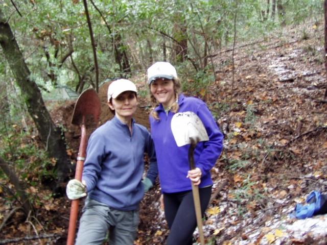
We met a volunteer group out at West Fork who was cleaning up the campground. We must keep on the lookout for this group because they did a great job.
There was a little issue with dehydration and not eating enough which left me feeling like I had West Nile Virus. After checking in with my brother in law (Dr. Dave) I have vowed to a new policy of drinking and eating more especially when it's hot.
The Facts:
On the road at 7:00;
Our route was up the Chantry road and around the small loop via the first water trail 11+ miles;
Lots of water out there still.
We drove out to Chantry Flat and parked in the shady spot under the tree. We had a great walk up the road as it was cloud covered and so not too hot. Canyon Dave passed us on the way up and suggested we meet him at the top. We joined Dave for part of his Patrol which was fun. We got to see half-dozen or so cabins, learned some history of the canyon and had a nice chat. Dave informed us of emergencies which could occur and instructed us on various escape routes. I trust that Sharon remembers the details.
Along the way we saw two rattlesnakes and one deer.
August 7, 2005
The Facts:
We were on the road from Sharon's house at 7:00am;
We hiked 12 miles;
The water is still running;
The bugs are swarming and if you don't have a headnet they will drive you completely insane.
It was a beautiful day to hike out to West Fork Campground and back the same way. We hauled two salt bricks for our "salt the deer mission."
When we got there, we saw two people sitting in camp chairs outside of the red cabin where the deer stall is. We chatted for a moment with them and learned they own the cabin which I had thought until now was a forest service/ranger cabin.
The peeps had brought their gardeners with blow machines to do their fire clearance. We learned that the cabin has electricity and plumbing and they drive in all the way right to their door. Since we now know they are the ones bringing the salt licks in the back of their SUV we have halted the "salt the deer mission."
We met a volunteer group out at West Fork who was cleaning up the campground. We must keep on the lookout for this group because they did a great job.
There was a little issue with dehydration and not eating enough which left me feeling like I had West Nile Virus. After checking in with my brother in law (Dr. Dave) I have vowed to a new policy of drinking and eating more especially when it's hot.
Subscribe to:
Posts (Atom)